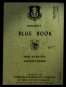
Saturday 2 March 2019

U.S. Government UFO Document:
“AIR INTELLIGENCE INFORMATION REPORT:
Subject: Unusual Radar Target/
Area Reported On: Duncanville, Texas, area/
From (Agency): 334 Air Div (Def)/
Date of Report: 7 Apr 52/
Date of Information: 16 Apr 52”


(Project Blue Book, U.S. Air Force, Washington, D.C.)

Source: NICAP.org

Quote from the document (not written in U.S. Department of Defense document format):
“3. The incident was reported as an unusual radar target.

4. This gives the target an estimated speed of 2160 MPH.”

Project Blue Book listed the case as “Unknown.”

NOTE: The UFO incident occurred on 4 April (not on 5 April) 1952, according to Brad Sparks and Dan Wilson.

Duncanville is situated near Dallas.


Related posts:


realtvufos.blogspot.com/search?q=1952


(ufocasebook.com image)


Satellite photo of Duncanville, Texas (tageo.com)
(tageo.com photo)

UFO Case Directory (RADCAT):
“Secret Report:
Unidentified Radar Return (BB 1095)
April 4, 1952
Duncanville, Texas”


(NICAP.org)

The whole UFO case report:
Fran Ridge:
In May of 2005 we found MAXW-PBB9-1289 (an AIIR, Air Intelligence Information Report) while looking for something else. Since I was working on White Sands cases I set it aside. Then, a week later, I stumbled across another reference. NARA-PBB85-654 mentioned an unidentified radar return. It was marked with brackets as secret. However, it was listed as having occurred on April 8th at 2000 hours (8:00 PM). I checked the NICAP Db and it wasn’t there, so I then went to the ‘Bluelist’, the outdated PBB Unknowns. Duncanville was listed, as Item 1095, and as April 5th. But Dan Wilson & Brad Sparks had noted the correct date as April 4th.

Brad Sparks:
April 4, 1952.  Duncanville, Texas (BBU 1095)
8:30 p.m. (CST)  USAF Cpl. Billy D. Greer and PFC John W. Harrington of the Radar Maintenance Section, 147th AC&W Squadron, tracked unidentified target by FPS-10 radar first to the NW at 310°-315° azimuth at about 70 nautical miles (80 miles) moving at high speed of about 2,160 knots (2,500 mph) until it disappeared off the scope at maximum range of 260 n.mi. (300 miles). Height-finder reading not taken, estimated at 42,000+ ft due to radar beam coverage at max range. (Jan Aldrich;  FUFOR Index)”

NICAP.org presents U.S. government (U.S. Air Force) documents that pertain to the UFO case.


Related posts:


realtvufos.blogspot.com/search?q=1952


Satellite photo of Duncanville, Texas (tageo.com)
(tageo.com photo)

UFO Case Directory (RADCAT):
“Airborne Radar Tracks 3,000 MPH Object
March 24, 1952
Near Conception, Calif.”


(NICAP.org)

The whole UFO case report:
Brad Sparks:
March 24, 1952, 60 miles W of Pt. Conception, Calif. (BBU 1077)
8:45 a.m. [p.m.?] B-29 navigator and radar operator tracked unidentified target on airborne radar at about 3,000 mph. (Berliner; Shough)

Dan Wilson:
March 24, 1952, 60 miles west of Point Conception, Calif.
At 8:45 a.m. PST, Lt. Hancock, Radar Observer, and Lt. Cone, Navigator, aboard a B-29 observed on the radar scope a clear and distinct radar return of an object with a calculated speed of 3000 MPH. The radar return was observed for 20-30 seconds. The altitude of the object was of less than 25,000 feet. Both observers were regarded as highly reliable officers.”

Point Conception, California, is situated in the south western part of Santa Barbara County.


Wikipedia article: “Boeing B-29 Superfortress”:


Related posts:


realtvufos.blogspot.com/search?q=1952


A USAAF B-29 Superfortress (text by Wikipedia)
(wikimedia.org) (wikimedia.org photo)


Point Conception and the Gaviota Coast from the air, looking SW. Lighthouse is visible in blowup (click) at top left center. To left (west) is Government Point, which partly encloses Cojo Bay. The Santa Ynez Mountains extend east (left) towards Santa Barbara. (text by Wikipedia) (wikimedia.org(wikimedia.org photo)